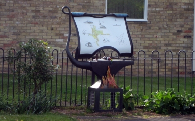

The history of Landbeach is well documented, thanks to a number of clergymen over the centuries and most recently the historian Jack Ravensdale[1].
Prehistory
Ravensdale suggests[2] that Landbeach was established as an outpost of Waterbeach for stationing sheep during floods.
An Iron-Age village has been discovered in the fields to the southeast of the village crossroads.
The Romans
Landbeach lies on a Roman road, called Akeman Street by the Anglo-Saxons, that ran from Bath in Somerset to Brancaster in Norfolk. The road still exists in the southern half of the village as the Mere Way cycle path and Akeman Street. At the northern end of the village it is now the route of the A10.
A canal joining the Old Ouse or Old West River to the River Cam or Granta, and passing through Landbeach, is believed to date from the Roman period. Parts of it are called the Car Dyke, although its relationship with the Car Dyke further north is unproven.[3]
The Iron-Age village was still in use during the Roman occupation.
The Dark Ages
The first record of Landbeach occurs in the Liber Eliensis, written in the 12th century but referring to events in the middle of the 10th century. It names two of the most important inhabitants, Oswi and Oschetel.
The Normans
Landbeach is mentioned in the Domesday Book of 1086 as Utbech. This name distinguished it from Bech, which we now know as Waterbeach, and probably refers to our village's greater distance from the River Cam.
Landbeach contained two manors dating from before the Conquest. One of them, formerly belonging to two of the king's cartwrights, was owned by the Bray family by 1229. A moat belonging to it can still be seen in Worts Meadow near the crossroads.
The other manor previously belonged to Blacuin and was taken over by Picot of Cambridge, a Norman sheriff, after the Conquest. It passed into the hands of the Chamberlain family before 1250. Some of its earthworks still exist in the fields of Rectory Farm behind All Saints' Church.
The rest of the village was organised as four open fields grazed by sheep and other cattle.
The Middle Ages
Corpus Christi college began to acquire Chamberlains Manor in 1359. The Manor of Brays was taken over by the Worts family, owners of Worts Farm, in the early 18th century. Both manors were acquired by the University during the Parliamentary Enclosure of 1813. At the same time, the division of the village into four open fields, for grazing of sheep and other cattle, came to an end.
Road transport
Since antiquity, the main road from Cambridge to Ely had passed through the middle of Landbeach. However, an Act of Parliament in 1763 ordered the upgrading of a path to the east of Landbeach into a turnpike road. This became the new road to Ely, now the A10.
[1] Ravensdale, Jack, "The Domesday Inheritance", 1986, ISBN 028562749X
[2] Ravensdale, J. R., "Liable to Floods", 1974, ISBN 052120285X
[3] Clay, William Keatinge, "A History of the Parish of Landbeach", 1861